
We are a team passionate about antiques and customer service. With trade and private clients worldwide we offer a complete sourcing, restoration and delivery network. From order to delivery our focus is on customer service.
Buy with Confidence Guarantee
We offer a 100% Total Satisfaction Guarantee: Every item we sell is covered by our Total Satisfaction Guarantee: If, within 14 days of receipt, you are unsatisfied with the item it may be returned for a full refund. Our business is nothing without customer service. Simply pack it up safely and return it to our address and we will provide a refund of the purchase price upon receipt.
London Fine Ltd
'%3e%3cpath fill='%23012169' d='M0 0v30h60V0z'/%3e%3cpath stroke='%23fff' stroke-width='6' d='m0 0 60 30m0-30L0 30'/%3e%3cpath stroke='%23C8102E' stroke-width='4' d='m0 0 60 30m0-30L0 30' clip-path='url(%23b)'/%3e%3cpath stroke='%23fff' stroke-width='10' d='M30 0v30M0 15h60'/%3e%3cpath stroke='%23C8102E' stroke-width='6' d='M30 0v30M0 15h60'/%3e%3c/g%3e%3c/svg%3e) Devon, UK

Address
The Antique Village, The Old Whiteways Cider Factory
Hele
Devon
United Kingdom
EX5 4PW
Opening times
10am - 4pm, Monday to Saturday
Phone
+442071 833511
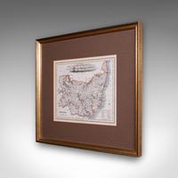
Antique County Map, Suffolk, Scottish, Framed Atlas Cartography, Victorian, 1840
REF: 26377 / LA591059
£495
€593
$668
Secure Payments By
LoveAntiques Dealersince May 2017Approved item3657 sales by dealerFree DeliveryAvailable for local pick-up
LoveAntiques Dealersince May 2017Approved item3657 sales by dealerFree DeliveryAvailable for local pick-up
Description
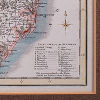
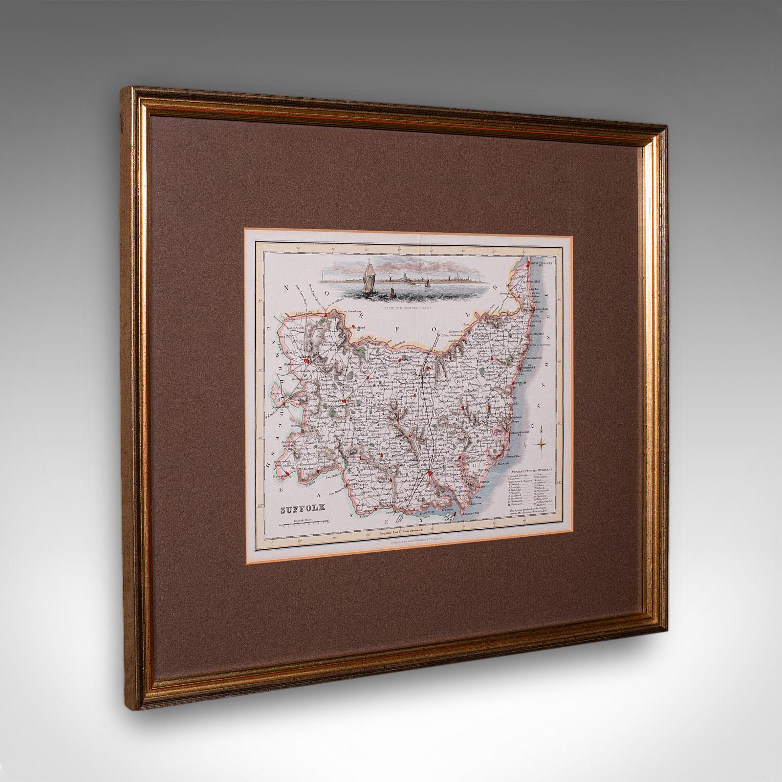
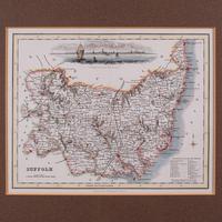
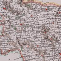
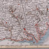
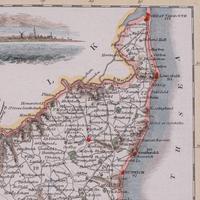
This is an antique county map of Suffolk. A Scottish, framed atlas engraving of cartographic interest, dating to the mid 19th century and later, circa 1840.
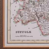
Charming lithography of Suffolk and its county detail, perfect for display
Displaying a desirable aged patina and in good order
Fascinating cartography, appealingly set within a quality, later frame
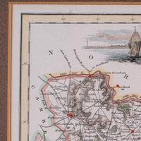
Hand-painted watercolour wash highlights borders, valleys and the coastline
This example published by Archibald Fullarton & Co. in Glasgow, circa 1840
It was compiled to accompany James Bell's A New and Comprehensive Gazetteer of England and Wales
Later republished by Fullarton in the highly regarded Parliamentary Gazetteer of England and Wales
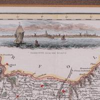
Accentuated with a superb maritime vignette 'Yarmouth from the Roads'
Detail given to The Hundreds, the administrative divisions within counties until the mid 19th century
Each major settlement is accompanied by its distance to London in miles
Dressed to the rear with hanging wire for ease of mounting
This is a quality antique county map of Suffolk, with fine cartographic interest and delightful period detail. Delivered ready to display.
Dimensions:
Max Width: 41.5cm (16.25'')
Max Depth: 2cm (.75'')
Max Height: 36.5cm (14.25'')
Map Width: 25.5cm (10'')
Map Height: 20cm (7.75'')
We offer a 100% satisfaction guarantee with all of our antiques.
We ship worldwide with professional packing and attractive rates – please send us your post / zip code and country for a quote.
Free delivery to most of the U.K. – Please send us your post code for confirmation.
Deliveries taking on average ten working days to arrive at your door from receipt of payment.
Please contact us if you require any further information - we are here to help.
measurements
Height:
36.5 cm
Width:
41.5 cm
Depth:
2 cm
declaration
London Fine Ltd has clarified that the Antique County Map, Suffolk, Scottish, Framed Atlas Cartography, Victorian, 1840 (LA591059) is genuinely of the period declared with the date/period of manufacture being c.1840
condition
Presented in good antique condition.
additional info
Category:
Origin:
Date of Manufacture:
c.1840
location
This Antique County Map, Suffolk, Scottish, Framed Atlas Cartography, Victorian, 1840 is located in Devon, United Kingdom
Share:
A selection of items from London Fine Ltd
London Fine Ltd has 1689 items available.Antique Suffolk County Map, Dutch, Atlas Novus, Joan Blaeu, Cartography c.1645
£ 925
€1,108$1,249
London Fine Ltd
Antique County Map, Rutlandshire, Framed Atlas Cartography, John Cary, Georgian
£ 345
€413$466
London Fine Ltd
Antique Devon County Map, English, Framed 17th Century Atlas Cartography c.1650
£ 595
€713$803
London Fine Ltd
Antique Stafford County Map, English, Atlas Engraving - 17th Century, Cartography
£ 695
€833$938
London Fine Ltd