1,200 Dealer Directory listings
250+ Active Dealers
Secure Payments via Stripe
Free Delivery Options
Categories
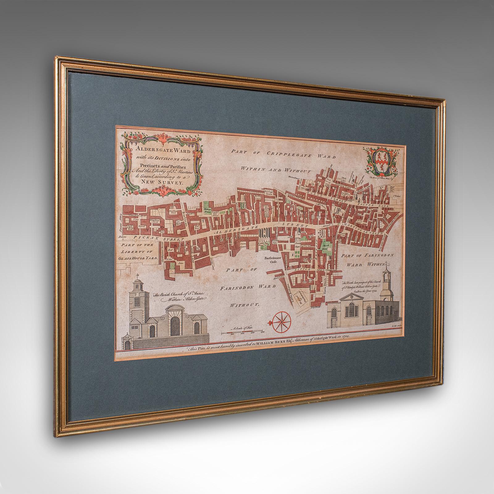
Antique London Street Map, Aldersgate, English, Framed, The Barbican, Georgian (1 of 11)
London Fine Ltd
Flag of United KingdomDevon, UK
We are a team passionate about antiques and customer service. With trade and private clients worldwide we offer a complete sourcing, restoration and delivery network. From order to delivery our focus is on customer service. Buy with Confidence Guarantee We offer a 100% Total Satisfaction Guarantee: Every item we sell is covered by our Total Satisfaction Guarantee: If, within 14 days of receipt, you are unsatisfied with the item it may be returned for a full refund. Our business is nothing without customer service. Simply pack it up safely and return it to our address and we will provide a refund of the purchase price upon receipt.
... See more

Address

The Antique Village, The Old Whiteways Cider Factory

Hele

Devon

United Kingdom

EX5 4PW

Opening times

10am - 4pm, Monday to Saturday

Phone

+442071 833511

Antique London Street Map, Aldersgate, English, Framed, The Barbican, Georgian

REF: 26150 / LA580556
£585
€683
$788
Secure Payments By
LoveAntiques Dealersince May 20173561 sales by dealerFree DeliveryAvailable for local pick-up
Description
This is an antique London street map. An English, framed and hand-coloured map showing the ward of Aldersgate, dating to the Georgian period and later, circa 1754. Full title: Aldersgate Ward with its Divisions into Precincts and Parishes and the Liberty of St Martins le Grand, according to a New Survey. Delightful London interest, as it stood when surveyed in the mid 18th century Presented behind clear bright glass and mounted within a tasteful deep green card border Displays a desirable aged patina, with a gilt-finished later frame Dressed to the rear with mounting wire for ease of hanging Title given within a decorative cartouche to the upper part of the map Hand coloured for added visual interest and legibility Heraldic interest with the family coat of arms for the cartographer William Benn Esquire Encompassing Aldersgate Street, Barbican and Trinity Chapel Fine architectural excerpts for the Churches of St Anne and St Botolph respectively Named and dated by William Benn in the year 1754 This is a charming 18th century London street map, with appealing lithography detail and tasteful presentation. Delivered ready to display. Dimensions: Max Width: 50cm (19.75'') Max Depth: 1cm (.5'') Max Height: 37.5cm (14.75'') Map Width: 37.5cm (14.75'') Map Height: 24cm (9.5'') We offer a 100% satisfaction guarantee with all of our antiques. We ship worldwide with professional packing and attractive rates – please send us your post / zip code and country for a quote. Free delivery to most of the U.K. – Please send us your post code for confirmation. Deliveries taking on average ten working days to arrive at your door from receipt of payment. Please contact us if you require any further information - we are here to help.
measurements
Height:
37.5 cm
Width:
50 cm
Depth:
1 cm
declaration
London Fine Ltd has clarified that the Antique London Street Map, Aldersgate, English, Framed, The Barbican, Georgian (LA580556) is genuinely of the period declared with the date/period of manufacture being c.1754
condition
Presented in good antique condition.
additional info
Material:
Origin:
Date of Manufacture:
c.1754
location
This Antique London Street Map, Aldersgate, English, Framed, The Barbican, Georgian is located in Devon, United Kingdom
Share: