
We are a team passionate about antiques and customer service. With trade and private clients worldwide we offer a complete sourcing, restoration and delivery network. From order to delivery our focus is on customer service.
Buy with Confidence Guarantee
We offer a 100% Total Satisfaction Guarantee: Every item we sell is covered by our Total Satisfaction Guarantee: If, within 14 days of receipt, you are unsatisfied with the item it may be returned for a full refund. Our business is nothing without customer service. Simply pack it up safely and return it to our address and we will provide a refund of the purchase price upon receipt.
London Fine Ltd
'%3e%3cpath fill='%23012169' d='M0 0v30h60V0z'/%3e%3cpath stroke='%23fff' stroke-width='6' d='m0 0 60 30m0-30L0 30'/%3e%3cpath stroke='%23C8102E' stroke-width='4' d='m0 0 60 30m0-30L0 30' clip-path='url(%23b)'/%3e%3cpath stroke='%23fff' stroke-width='10' d='M30 0v30M0 15h60'/%3e%3cpath stroke='%23C8102E' stroke-width='6' d='M30 0v30M0 15h60'/%3e%3c/g%3e%3c/svg%3e) Devon, UK
Devon, UK
Address
The Antique Village, The Old Whiteways Cider Factory
Hele
Devon
United Kingdom
EX5 4PW
Opening times
10am - 4pm, Monday to Saturday
Phone
+442071 833511
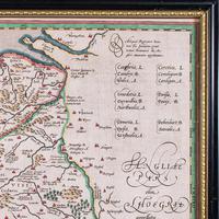
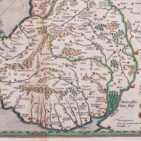
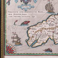
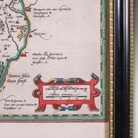
Antique Map of Wales, Belgian, Framed Atlas Excerpt, Elizabethan, Humphrey Llwyd
REF: 26330 / LA588703
£795
€939
$1,050
Secure Payments By
LoveAntiques Dealersince May 2017Approved item3626 sales by dealerFree DeliveryAvailable for local pick-up
LoveAntiques Dealersince May 2017Approved item3626 sales by dealerFree DeliveryAvailable for local pick-up
Description
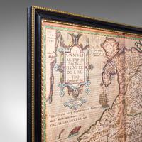
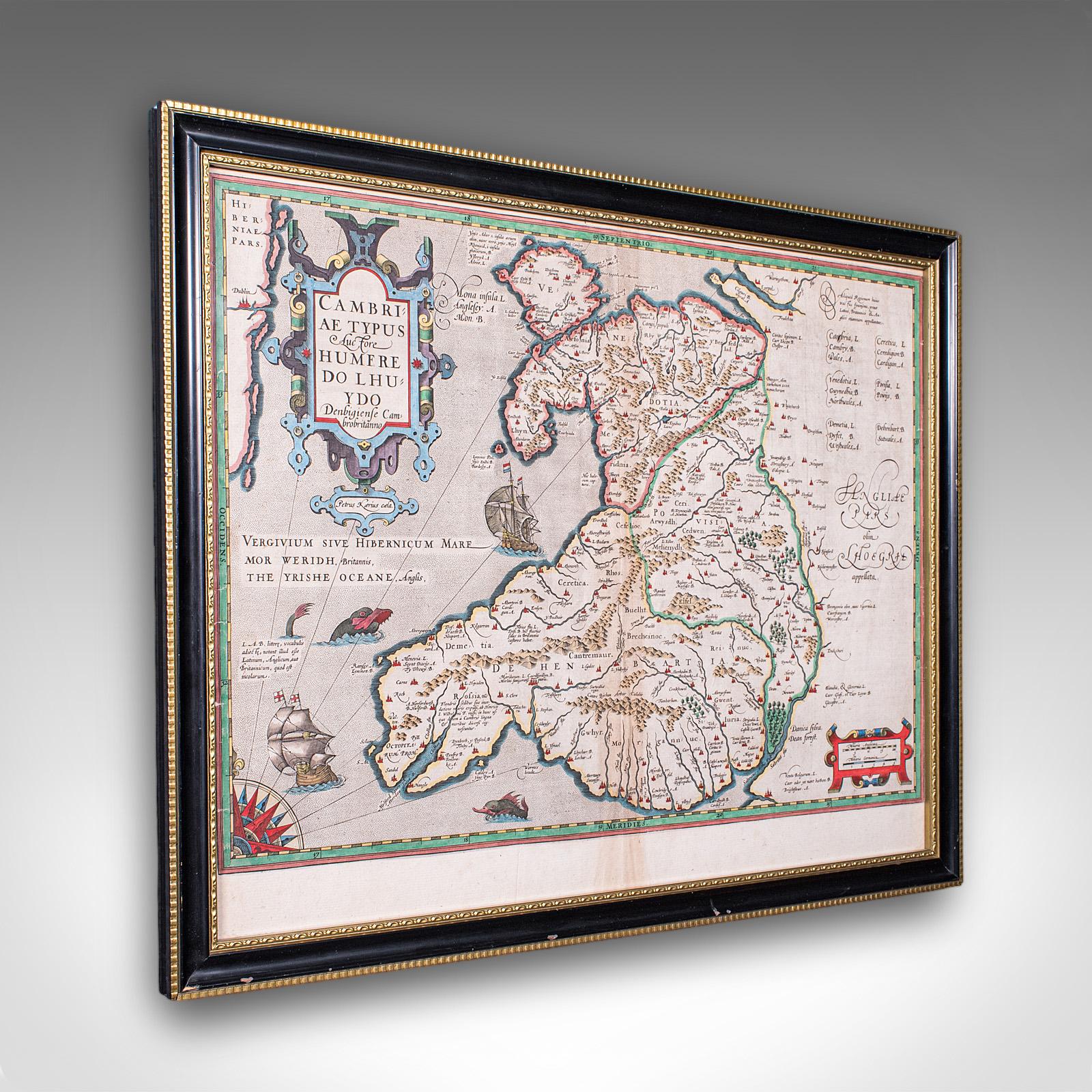
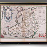
This is an antique map of Wales. A Belgian, framed atlas excerpt with dual sided mount, this example from the Theatrum Orbis Terrarum published in 1592 during the late Elizabethan period.
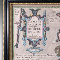
Full title: CAMBRIAE TYPUS - Auctore Humfredo Lhuydo - Denbigiense Cam brobritanno, translating into English as 'A Map of Wales, by the author Humphrey Llwyd of Denbigh, a Welsh Briton'
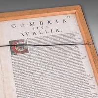
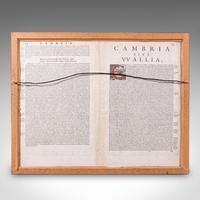
Recognised as the first ever published map that set Wales as its own region, Humfredo Lhuydo's 1568 original was added to the addendum of the Flemish cartographer Abraham Ortelius' atlas, Theatrum Orbis Terrarum, with the text entry compiled from Lhyudo's own manuscripts. This quality late-16th century example is from the 1592 volume, verified by the plate numbers on the reverse. This reverse aspect traces the origins of the Welsh people, discusses the etymology of the names Cambria and Wallia, outlines the boundaries of the historic principalities (Gwynedd, Powys, and Deheubarth), and details the language and customs of the inhabitants.
A superb, historic map of the Renaissance period, ready to display. Presents a desirable aged patina, in good original order. Tasteful later frame with an ebonised and gilt finish. Atlas excerpt is presented behind, clear bright glass in dual sided accent.
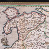
Printed in 1592 in Antwerp, at the city's famous printing house In Officina Plantiniana. Excellent colour accentuates the decorative title cartouche, borders and maritime icons. Presents three regions across Wales as it was in the 16th century. Reverse hosts the fascinating atlas entry, and dressed with hanging wire for ease of mounting.
This antique map of Wales is a truly excellent, exciting publication within the history of European cartography, offering an example of the very first published map of Wales as its own region, presented here as a culturally rich, high quality piece within a celebrated atlas. A treat for collectors and Welsh natives alike. Delivered ready to display.
We offer a 100% satisfaction guarantee with all of our antiques.
Please contact us if you require any further information - we are here to help.
measurements
Height:
43.5 cm
Width:
55 cm
Depth:
2 cm
Map Width: 49.5cm (19.5'')
Map Height: 38.5cm (15.25'')
declaration
London Fine Ltd has clarified that the Antique Map of Wales, Belgian, Framed Atlas Excerpt, Elizabethan, Humphrey Llwyd (LA588703) is genuinely of the period declared with the date/period of manufacture being c.1592
condition
Presented in good antique condition
additional info
Period:
Category:
Origin:
Date of Manufacture:
c.1592
location
This Antique Map of Wales, Belgian, Framed Atlas Excerpt, Elizabethan, Humphrey Llwyd is located in Devon, United Kingdom
Share:
A selection of items from London Fine Ltd
London Fine Ltd has 1687 items available.Antique Dual Sided Carnarvonshire Map, Atlas Excerpt, North Wales, Cartography
£ 395
€466$522
London Fine Ltd
Antique City of Exeter Map, English, Framed, Atlas Excerpt - Georgian c.1805
£ 195
€230$258
London Fine Ltd
Antique Region Map, South Wales, English, John Cary, Framed, Atlas - Georgian
£ 425
€502$561
London Fine Ltd
Antique Map of Breconshire, Dutch, Atlas Cartography, Joan Blaeu, Wales c.1660
£ 895
€1,057$1,182
London Fine Ltd