
We are a team passionate about antiques and customer service. With trade and private clients worldwide we offer a complete sourcing, restoration and delivery network. From order to delivery our focus is on customer service.
Buy with Confidence Guarantee
We offer a 100% Total Satisfaction Guarantee: Every item we sell is covered by our Total Satisfaction Guarantee: If, within 14 days of receipt, you are unsatisfied with the item it may be returned for a full refund. Our business is nothing without customer service. Simply pack it up safely and return it to our address and we will provide a refund of the purchase price upon receipt.
London Fine Ltd
'%3e%3cpath fill='%23012169' d='M0 0v30h60V0z'/%3e%3cpath stroke='%23fff' stroke-width='6' d='m0 0 60 30m0-30L0 30'/%3e%3cpath stroke='%23C8102E' stroke-width='4' d='m0 0 60 30m0-30L0 30' clip-path='url(%23b)'/%3e%3cpath stroke='%23fff' stroke-width='10' d='M30 0v30M0 15h60'/%3e%3cpath stroke='%23C8102E' stroke-width='6' d='M30 0v30M0 15h60'/%3e%3c/g%3e%3c/svg%3e) Devon, UK
Devon, UK
Address
The Antique Village, The Old Whiteways Cider Factory
Hele
Devon
United Kingdom
EX5 4PW
Opening times
10am - 4pm, Monday to Saturday
Phone
+442071 833511
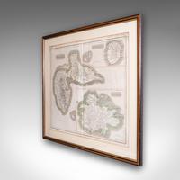
Large Antique Caribbean Map, Guadeloupe, Antigua, Scottish, Framed - Georgian
REF: 26283 / LA586062
£985
€1,147
$1,314
Secure Payments By
LoveAntiques Dealersince May 2017Approved item3609 sales by dealerFree DeliveryAvailable for local pick-up
LoveAntiques Dealersince May 2017Approved item3609 sales by dealerFree DeliveryAvailable for local pick-up
Description
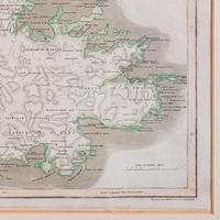
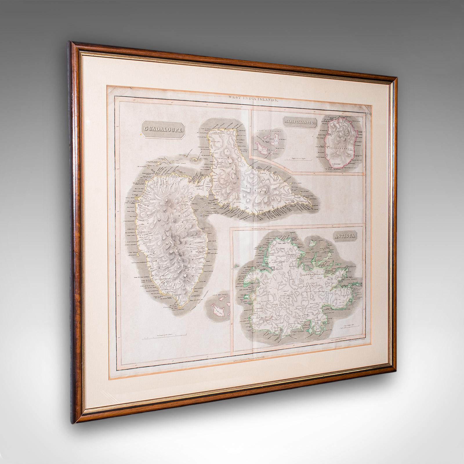
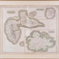
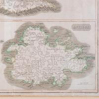
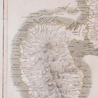
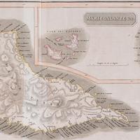
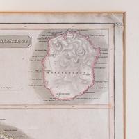
This is a large antique map of the West India Islands. A Scottish, framed triptych of three Caribbean Leeward islands, dating to the late Georgian period, circa 1817.
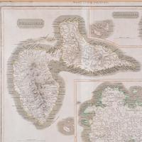
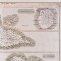
A fine excerpt from John Thompson's (1777 - 1841) A New General Atlas of 1817, presenting the three islands from the Caribbean Leeward Isles with contemporary naming - Guadaloupe, Mariegalante and Antigua.
Impressive scale and appealing 19th century cartography as entered within an atlas. It displays a desirable aged patina and in gently time-worn order, commensurate with age. Set within a tasteful later frame, behind clear and bright glass. Map within a cream card border, with mounting wire to the reverse.
Engraved by Kirkwood & Son of Edinburgh from John Thompson's cartography. Presents Guadeloupe, Antigua and Marie-Galante as individual insets. Each hand-coloured to the border, and annotated with a high level of detail. Shows place names, topography and scale for each island.
This is a fascinating antique map of the West India Islands, known today as the CAribbean Leeward Islands. Delightfully annotated with copious information and detail, this large map is a treat for collectors or for those with a connection to the islands featured. Delivered ready to display.
We offer a 100% satisfaction guarantee with all of our antiques.
Please contact us if you require any further information - we are here to help.
measurements
Height:
67.5 cm
Width:
77 cm
Depth:
2 cm
Map Width: 62cm (24.5'')
Map Height: 51cm (20'')
declaration
London Fine Ltd has clarified that the Large Antique Caribbean Map, Guadeloupe, Antigua, Scottish, Framed - Georgian (LA586062) is genuinely of the period declared with the date/period of manufacture being c.1820
condition
Presented in good antique condition.
additional info
Category:
Origin:
Artisan:
Date of Manufacture:
c.1820
location
This Large Antique Caribbean Map, Guadeloupe, Antigua, Scottish, Framed - Georgian is located in Devon, United Kingdom
Share:
A selection of items from London Fine Ltd
London Fine Ltd has 1676 items available.Antique Jamaica Map, English, Caribbean, Cartography, Thomas Jefferys, Georgian
£ 895
€1,042$1,194
London Fine Ltd
Large Antique Lithography Map, Northamptonshire, Framed Cartography - John Speed
£ 795
€926$1,061
London Fine Ltd
Antique County Map, Cornwall, Kernow, English, Framed - Robert Morden - Georgian
£ 595
€693$794
London Fine Ltd
Antique Coaching Road Map, South Devon, English, Framed, Cartography, Georgian
£ 295
€344$394
London Fine Ltd