Get alerts of the antiques that interest you as soon as they are uploaded

£ 395
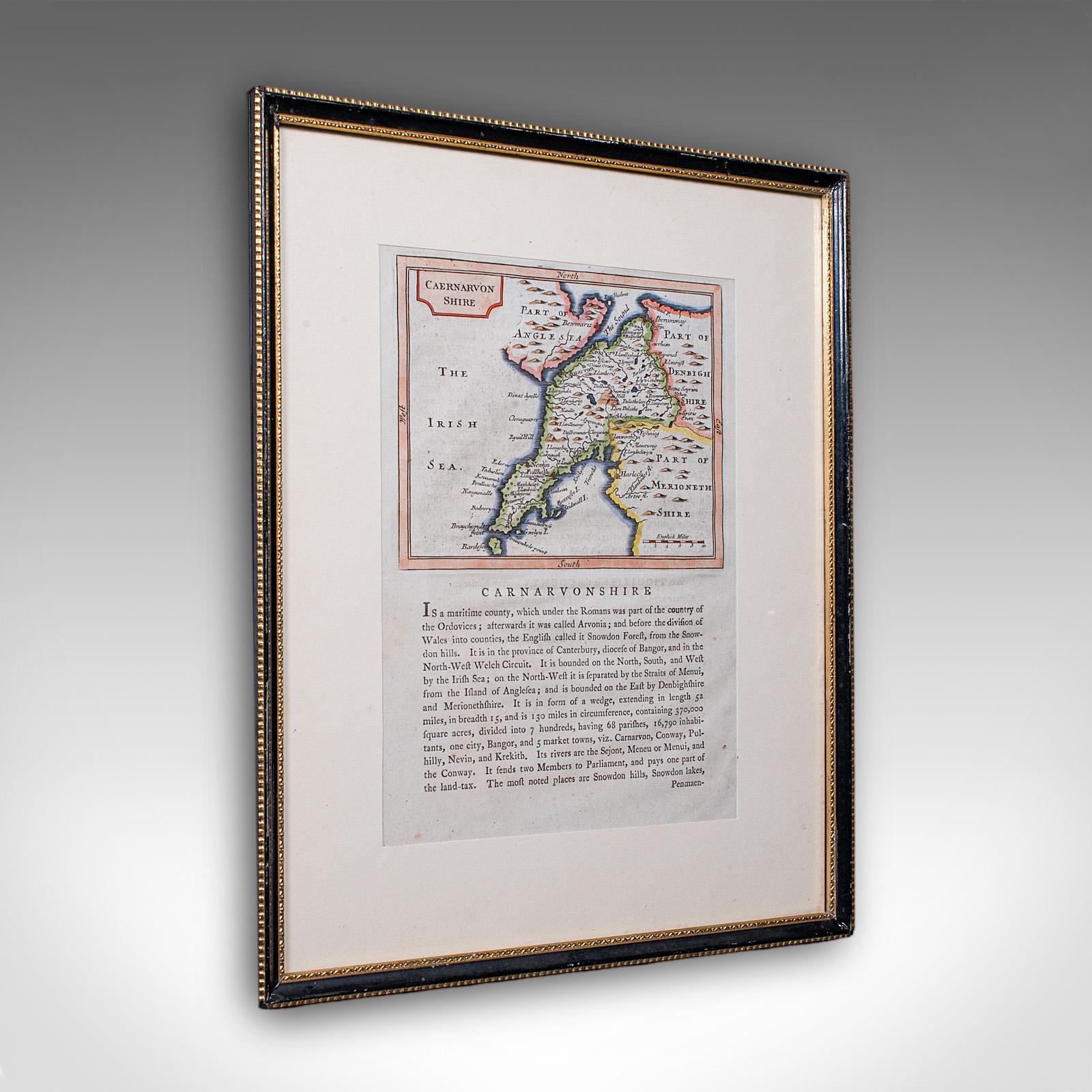
Antique Dual Sided Carnarvonshire Map, Atlas Excerpt, North Wales, Cartography
£ 395
London Fine Ltd
Wickersley Antiques
A Georgian Map Sampler
£ 300
Elder Books & Collectables
1821 The Parish of Christ Church Surrey Scarce Hand Coloured London Plan
£ 75
1821 The Parish of Christ Church Surrey Scarce Hand Coloured London Plan
£ 75
Elder Books & Collectables
£ 295
Antique Lithography Map, Worcestershire, English, Framed Engraving, Cartography
£ 295
London Fine Ltd
£ 585
Antique Paterson's Guide to Britain, English, Maps, Georgian, Published 1811
£ 585
London Fine Ltd
Will Thomas - Architectural Antiques
1823 Map of England & Wales Including Principal Part of Scotland Map by William Darton
£ 550
1823 Map of England & Wales Including Principal Part of Scotland Map by William Darton
£ 550
Will Thomas - Architectural Antiques
Williams Antiques & Restoration
Original Map of Bedfordshire Engraved by John Cary 1805
£ 90
Get alerts of the antiques that interest you as soon as they are uploaded