Get alerts of the antiques that interest you as soon as they are uploaded
£ 295
Antique Coaching Road Map, South Devon, English, Framed, Cartography, Georgian
£ 295
London Fine Ltd
£ 295
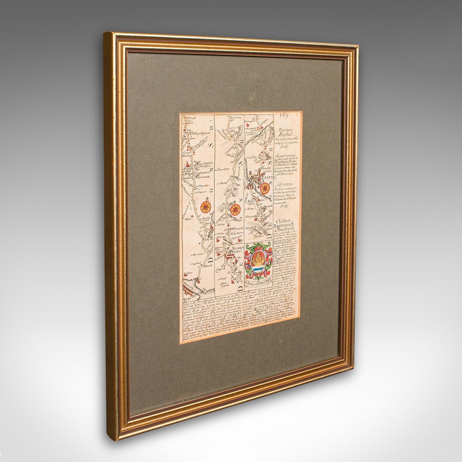
Antique Coach Road Map, East Devon, English, Framed, Cartography - Georgian c.1720
£ 295
London Fine Ltd
£ 395
Antique Lithography Map, Black Sea, English, Framed, Cartography, Victorian
£ 395
London Fine Ltd
£ 395
Antique Lithography Map, Durham, English, Framed, Cartography, Early Georgian
£ 395
London Fine Ltd
Elder Books & Collectables
1786 Miniature Map of Gloucestershire by E Bowen Hand Coloured in Maple Frame
£ 65
1786 Miniature Map of Gloucestershire by E Bowen Hand Coloured in Maple Frame
£ 65
Elder Books & Collectables
Elder Books & Collectables
1750 Miniature Map of Herefordshire by Thomas Osborne Hand Coloured Framed
£ 45
1750 Miniature Map of Herefordshire by Thomas Osborne Hand Coloured Framed
£ 45
Elder Books & Collectables
Elder Books & Collectables
1695 Large Hand Coloured Map of Monmouthshire South Wales by Robert Morden
£ 75
1695 Large Hand Coloured Map of Monmouthshire South Wales by Robert Morden
£ 75
Elder Books & Collectables
Elder Books & Collectables
Original 19th Century World Hemisphere Map West & East Coloured c.1850
£ 48
Original 19th Century World Hemisphere Map West & East Coloured c.1850
£ 48
Elder Books & Collectables
£ 85
£ 585
Antique Paterson's Guide to Britain, English, Maps, Georgian, Published 1811
£ 585
London Fine Ltd
Will Thomas - Architectural Antiques
1823 Map of England & Wales Including Principal Part of Scotland Map by William Darton
£ 550
1823 Map of England & Wales Including Principal Part of Scotland Map by William Darton
£ 550
Will Thomas - Architectural Antiques
Andrew Cox Antiques
Mid 19th Century Map of the County of Essex
£ 45
£ 65
£ 675
Antique Folding London Map, English, Cartography, Historic, Georgian, Dated 1783
£ 675
London Fine Ltd
Art & Stuff
John Cary: 18th Century Map of Derbyshire
£ 68
Elder Books & Collectables
1914-15 Collection of Early Mountaineering Journals The Alpine Journal + Maps
£ 180
1914-15 Collection of Early Mountaineering Journals The Alpine Journal + Maps
£ 180
Elder Books & Collectables
Elder Books & Collectables
1640s Hand Coloured Map of Yorkshire by Jan Jannson
£ 275
Art & Stuff
Robert Morden: Map of Staffordshire ca.1695
£ 125
Elder Books & Collectables
1834 County Map of Bedford by C & J Greenwood
£ 90
Elder Books & Collectables
1750 Map of Worcestershire by John Rocque
£ 45
Elder Books & Collectables
1741 Map of Worcestershire by Badeslade & Toms
£ 40
Elder Books & Collectables
1880 The Improved District Railway Map of London
£ 450
£ 85
Elder Books & Collectables
1620 Map of Herefordshire by John Speed
£ 475
Wessex House Antiques
Antique Map of Wiltshire and Its Hundreds by Bowen c.1755
£ 450
Elder Books & Collectables
1645 Copper Engrave Map of the Counties of Warwickshire & Worcestershire by J. Blaeu
£ 260
1645 Copper Engrave Map of the Counties of Warwickshire & Worcestershire by J. Blaeu
£ 260
Elder Books & Collectables
Elder Books & Collectables
1844 Map of the Peninsula of India by J. Wyld
£ 250
Williams Antiques & Restoration
Victorian Hand Coloured Map of Norfolk
£ 75
Williams Antiques & Restoration
Victorian Hand Coloured Map of Hertfordshire
£ 80
Williams Antiques & Restoration
Large Decorative Map of the County of Bedfordshire c.1900
£ 140
Large Decorative Map of the County of Bedfordshire c.1900
£ 140
Williams Antiques & Restoration
Get alerts of the antiques that interest you as soon as they are uploaded