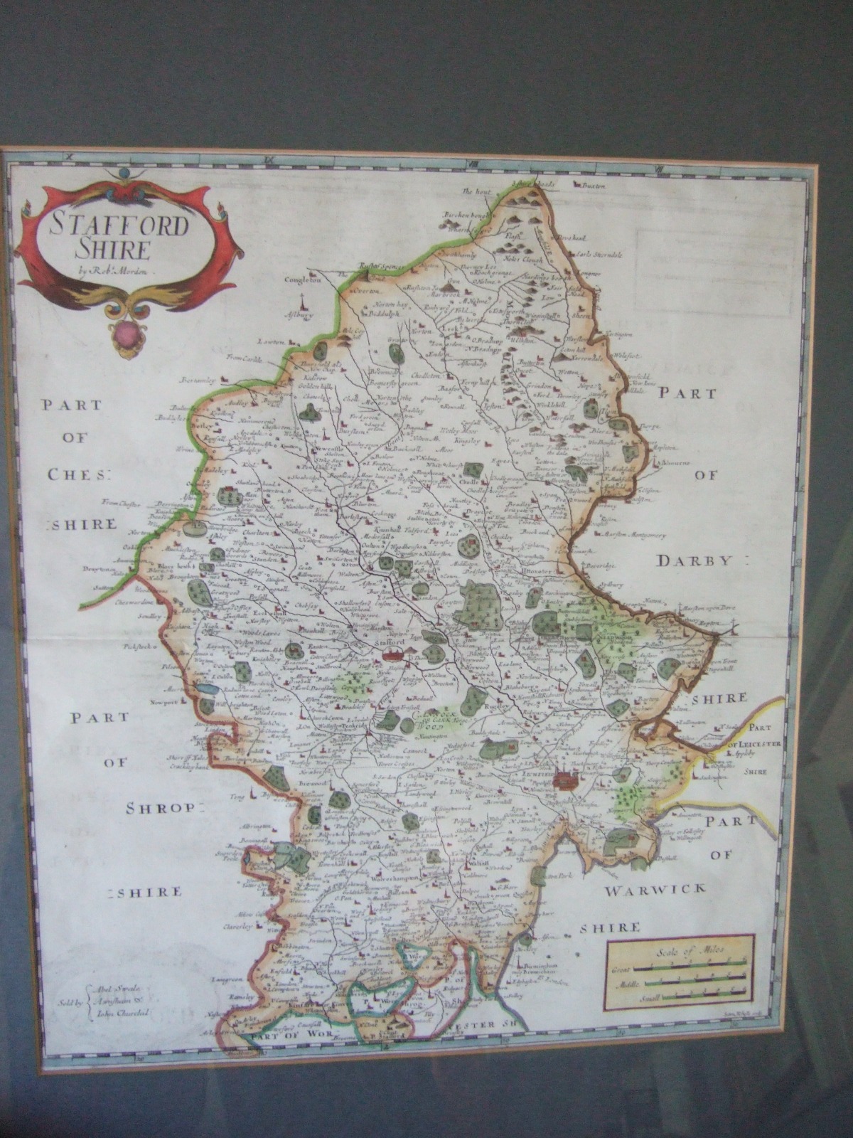
Art & Stuff
Robert Morden: Map of Staffordshire ca.1695
£ 125
Elder Books & Collectables
1834 County Map of Bedford by C & J Greenwood
£ 90
Neville Platt Antiques
Map of Leicestershire. Hand Coloured c.1840
£ 40
£ 50
Early Victorian Map of Gloucestershire Dated 1839, Showing the First "Railroads"
£ 50
Art & Stuff
Elder Books & Collectables
1750 Map of Worcestershire by John Rocque
£ 45
Elder Books & Collectables
1741 Map of Worcestershire by Badeslade & Toms
£ 40
Charles Jarvis Ltd
Map of Scotland by J Bartholomew & Sons
£ 200
Elder Books & Collectables
1880 The Improved District Railway Map of London
£ 450
£ 85
Phyllis Arnold Gallery Antiques
Antiquarian Map of Ireland c.1856
£ 195
Phyllis Arnold Gallery Antiques
New Map of Ireland
£ 210
Elder Books & Collectables
1680 John Ogilby Road Map, London to Shrewsbury
£ 125
Elder Books & Collectables
1620 Map of Flintshire, North Wales by John Speed
£ 460
Elder Books & Collectables
1620 Map of Herefordshire by John Speed
£ 475
Phyllis Arnold Gallery Antiques
Chart of Carlingford Lough by Capt Greenvile Collins
£ 300
Wessex House Antiques
Antique Map of Wiltshire and Its Hundreds by Bowen c.1755
£ 450
Elder Books & Collectables
1645 Copper Engrave Map of the Counties of Warwickshire & Worcestershire by J. Blaeu
£ 260
1645 Copper Engrave Map of the Counties of Warwickshire & Worcestershire by J. Blaeu
£ 260
Elder Books & Collectables
Elder Books & Collectables
1844 Map of the Peninsula of India by J. Wyld
£ 250
Elder Books & Collectables
1676 Copper Engraved Map of the County of Essex by John Speed
£ 565
1676 Copper Engraved Map of the County of Essex by John Speed
£ 565
Elder Books & Collectables
Williams Antiques & Restoration
Victorian Hand Coloured Map of Norfolk
£ 75
Williams Antiques & Restoration
Victorian Hand Coloured Map of Hertfordshire
£ 80
Williams Antiques & Restoration
Large Decorative Map of the County of Bedfordshire c.1900
£ 140
Large Decorative Map of the County of Bedfordshire c.1900
£ 140
Williams Antiques & Restoration